At the beginning of 2018 I was invited to write a regular guest blog for the website of a backpacking organisation on the theme of Dartmoor. The site has unfortunately closed as the owner decided to walk off into the sunset and retire. So as not to let my efforts go to waste the following is my collection of regular posts rolled into one article 9 Great Places for Photography on Dartmoor. It would have been ten but I only managed nine posts before the site closed.
1. Rundlestone Red Telephone Box
Dartmoor’s 365 square miles of moorland is famous for it’s bleak nature and legendary fog. On grey day it is easy to see why Arthur Conan Doyle used the moor as a backdrop for his Hound of the Baskervilles and why it was chosen as a location go the notorious Dartmoor Prison. Being one of the highest points on the south-west peninsula it is also the most likely location for a decent covering of snow.
This red telephone phone box is located on the B3357 between Tavistock and Princetown (SX575749) and it is one of my favourite locations whenever it snows. It is an east landmark when crossing the high moor from Okehampton and a welcome sight for participants in the annual Ten Tors Challenge.
As you can see from the picture above, there’s nothing bleak about Dartmoor on a beautiful sunny winter’s day, beware though the weather out on the moor can change quickly so it’s best to be prepared for all weathers when out.
2. South Hessary Tor
Dartmoor is famous for its tors, large rocky outcrops rising from the gentle hillsides below. Formed in the earth’s crust millions of years ago the hard granite of the tors has been exposed as the softer rocks above weathered and eroded away.
South Hessary Tor (SX597723), in the photo above is one of the smaller Tors on the moor, about 3/4 of a mile from Princetown along a well maintained track, it is the ideal place for a post Sunday lunch stroll or for the more intrepid of you it lies along the route of the Abbots Way. The track is very popular with both walkers and cyclists and has recently undergone extensive renovations. On a clear day the top of the tor gives panoramic views of southern Dartmoor with Plymouth and the sea to the south and the River Tamar and Cornwall beyond. The tor has acted as a marker and boundary for many areas in the past including the boundary of the lands of Buckfast Abbey, Walkhampton Manor, the Plympton Stannary and Plymouth Corporation Water catchment areas.
More information on the tor can be found here on the Legendary Dartmoor website.
This photograph was taken early one snowy morning with the sun just burning off the mist and cloud.
Can you spot the animal lurking in the cloud?
3. Lydford Gorge
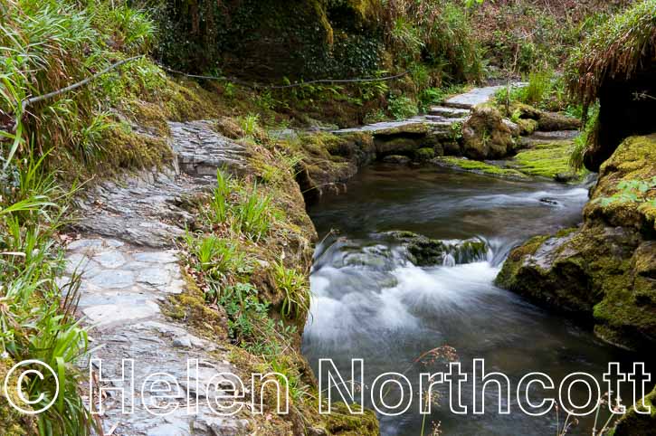
Dartmoor is much more than the high bleak moorland covered in gorse and heather and shrouded in thick mist. On the western fringes of the moor runs the River Lyd, raising at Lyd Head on the high moor and meandering across western edge of Devon before running into the River Tamar near Lifton. Just outside Lydford village the river runs through the deepest gorge in South-west England, Lydford Gorge.
The gorge has been managed by the National Trust since 1947 and is a 1.5 mile long, 100 foot deep, steep sided valley which is home to an abundance of wildlife, and lush flora and fauna which thrive in the sheltered conditions of the narrow valley. There is a circular walk of about 3 miles around the gorge which can be slippery and uneven underfoot but definitely well worth a wander on a fine day in spring when the valley sides are carpeted with bluebells.
This photograph shows the uneven pathway along the edge of the river at the bottom of the gorge, to me it looks like it could be somewhere far more remote and exotic than Devon.
More information about the gorge can be found on the National Trust’s website.
4. Nun’s Cross / Siwards Cross
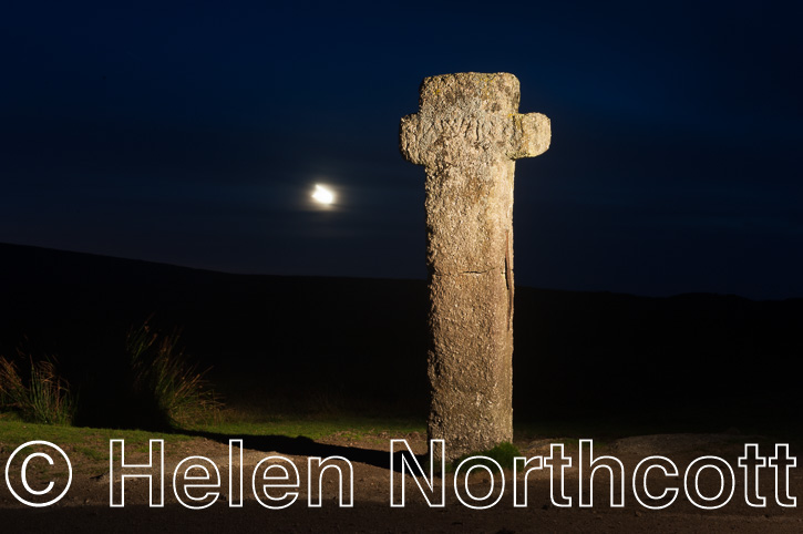
Scattered across Dartmoor are dozens of stone crosses dating back hundreds of years. Many of the crosses mark boundaries of the land owning estates, others mark safe routes across some of the dangerous bogs of the high moorland.
Nun’s Cross (SX604699) or Siward’s Cross as it is sometimes known is a way-marker at the junction of the Abbot’s Way, running from Buckfast Abbey to Tavistock Abbey, and the Monk’s way, to Buckland Abbey. It is the largest and oldest recorded cross on the moor being recorded in the Perambulation of Dartmoor Forest in 1240. The cross is believed to have been erected sometime between 1042 and 1066. It was knocked down and broken in 1846 but repaired and re-erected in 1848 at the insistence of a local landowner.
5. Bellever Clapper Bridge
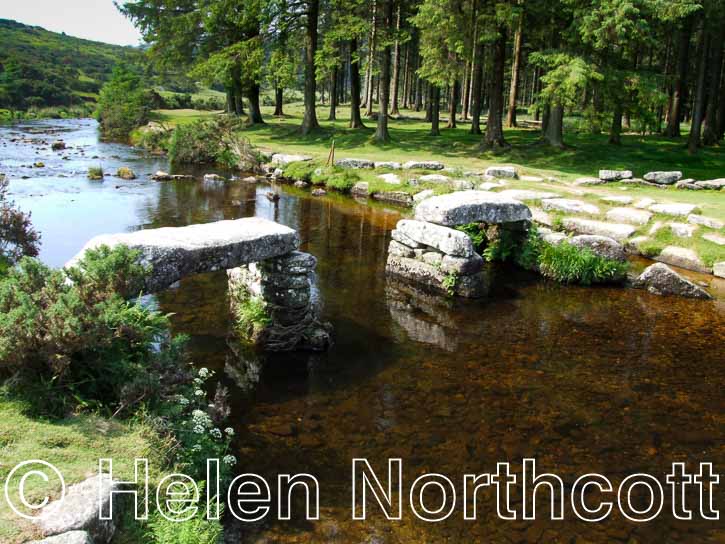
As long as people have lived on Dartmoor they have needed to find safe and easy crossing places over the many rivers of the high moor. The clapper bridge is an ancient bridge made of large slabs of granite supported on stone pillars. Most of Dartmoor’s clapper bridges were built in the middle ages, though many think they are much older. Despite most main route crossings having been spanned by newer bridges many of the clapper bridges on the moor remain intact or at least mostly so.
This clapper bridge spans the East Dart River at Bellever (SX658773) and has sadly lost it’s middle section. It is a few miles down river of Postbridge, home to Dartmoor’s most famous bridge. Until 1931 Bellever was a working farm, at this time the land was bought by The Forestry Commission and they began to plant the coniferous forest we see today. Several workers cottages were built and the farm outbuildings leased to the Youth Hostel Association. The hostel at Bellever is now the oldest still operating Hostel in the UK.
The public have free access to the plantation where there are a number of way-marked routes for weekend walkers and families. The forest roads are also popular with cyclists. More information can be found on the Forestry Commission website.
6. Burrator Reservoir
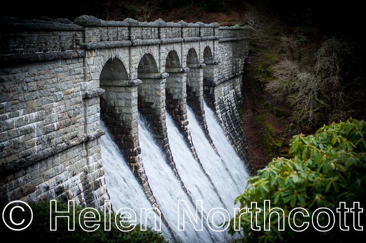
Dartmoor is notorious for its rain. As a high plateau in south Devon it is subject to very different climatic conditions to the surrounding low lying areas. If it’s going to rain anywhere in Devon it will probably be on Dartmoor and with an annual average rainfall of around 2 metres it rains a lot! Burrator Reservoir (SX550680) on the southern edge of the moor was built to take advantage of this rainfall, to provide water to Plymouth and surrounding area.
Since the 16th Century Dartmoor’s rainfall has been a valuable resource exploited by the city of Plymouth. One of the first municipal water supplies in the country was Drake’s Leat, built between 1590 and 1591 the meandering ditch took water from the river Meavy high on Dartmoor down to Plymouth to provide power for mills and excess water was available for connection to homes, though only about 30 houses were ever connected.
By the late 19th Century the population of Plymouth was expanding rapidly and was in need of a more reliable source of clean water. It was decided that a new reservoir should be built, damming the River Meavy to form a reservoir, the works were completed in 1898. The two dams of the original reservoir were raised by 10 feet in 1923 to increase the capacity to 1,026 million gallons.
The area around the reservoir is now a nature reserve with way-marked trails, the perimeter road of the lake is popular with runners, cyclists and walkers. Much of the valley has been planted with coniferous forest but the original Drake’s Leat is still visible along with old roads and several farms that were abandoned when the reservoir was built.
This photograph is of the main Burrator Dam (SX550680) which rises 23.5 metres above the river. It is quite common in winter to see water cascading over the overflow particularly after heavy rain.
More information about the area can be found on the SW Lakes Trust website and more details about the construction of the dam can be found on the Devon Heritage website.
7. Powder Mills
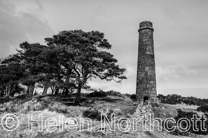
When we think of Dartmoor we often think of the wilderness as an untamed natural landscape, untouched by man. This is very much not the case, if you scan any map you will see evidence Dartmoor’s rich industrial past dating back as far as the iron age in the form of settlements, min workings and tracks. Until much more recently the moor was home to many mining and quarrying activities, between Princetown and Postbridge you will find Powder Mills (SX629771) and the remains of an 19th Century Gunpowder factory.
The site for Powder Mills was chosen because it was remote enough from any settlements so that any accidental explosions would not endanger the public but also because it was within easy reach of many tin and copper mines and quarrying activities that needed the gunpowder for their operations. Many farmers also used gunpowder to help clearing rock from land to be enclosed.
The mill was powered by water taken from the Cherrybrook River, you can still see the engine houses and the remains of the water channels. Across the site are many buildings, without roofs; it is said they used canvas to act as a weak spot in case of explosion to reduce the rick of damage to the structure of the buildings. This photograph is of one of the two chimneys still standing. The factory was abandoned in 1897 following the invention of dynamite and a decline in mining activities in the area.
More information about the site can be found on the Legendary Dartmoor website.
8. Vixen Tor
Dartmoor is a 365 square mile area of upland and moors in the south-west of England. It is the highest area in the region and provides access to a wide range of farming and recreational activities. Dartmoor is criss-crossed by miles of footpaths, bridleways and country lanes which give residents and visitors access to the open countryside. In addition to these designated rights of way much of Dartmoor is designated as access land which enables the public to access much more of the moor than that covered by rights of way.
Access land enables the public to walk across Dartmoor and experience the closest thing to wilderness in the UK as long as they are responsible and do not damage the landscape or cause distress to livestock or wildlife living on the moor. Access land enables the public to reach most of Dartmoor’s iconic tors on foot and experience the towering rock stacks at close quarters and in the majority of cases this works for all parties. Unfortunately access to all of the tors is not possible as some landowners have closed off public access causing great controversy. Vixen Tor on the west of Dartmoor is one such tor, which was accessible to the public until 2003 when a new landowner closed off public access stating insurance liability concerns as a reason for closing the area. The full convoluted story about the access controversy can be read on the Legendary Dartmoor website.
This photograph of Vixen Tor (SX540742) was taken from access land surrounding the disputed area. Barbed wire and yellow paint daubed on stones and gateposts make it plainly obvious that the public are not welcome to enjoy this most iconic tor. Hopefully in due course the land will be sold on to new owners who are more sympathetic to visitors.
9. The Pimple
On the edge of Dartmoor, above the market town of Tavistock you will find an architectural folly known as The Pimple (SX491735). This local landmark on open downland just inside the National Park is a popular area for recreation for the people of Tavistock and beyond.
The Pimple was built by Sir Edwin Lutyens in 1914 for the Duke of Bedford, who commissioned to renowned architect to create the entrance to an underground reservoir, built to supply his estate with water. The Grade II listed building is triangular in plan, each side measuring a little over 13 feet in length and decorated with a simple ball finial at the point of the roof. One side of the building has a simple wooden door giving access to a stairway down into the 100,000 gallon chamber.
The reservoir was by-passed in the early 1990’s and is now more than any other time a folly on the hill. The Pimple and it’s reservoir are now in private ownership with the understanding that the owners maintain the property. Sadly neglect, vandalism and the elements are taking their toll on this lovely spot. Hopefully some long overdue maintenance will be carried out to save the Pimple for generations to come.


